GIS Projects and Services
From 2015–2018, CISR conducted multiple innovative GIS and mapping projects sponsored by the U.S. Department of State. In partnership with faculty and students from James Madison University’s Geographic Science Program, CISR conducted a widespread needs assessment from global leaders at the intersection of humanitarian mine action and information management.

CISR/JMU identified the major GIS operational and reporting needs of the community used to create tools directly addressing those issues. The work resulted in the CISR ArcGIS Online Survey Tool (CAST), an integrated GIS tool using the ESRI company’s ArcGIS Online platform. The tool allows clearance operators to record spatial and qualitative information directly into geodatabases using mobile technology.
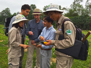
CISR/JMU, in partnership with Norwegian People’s Aid and Project RENEW, then successfully piloted CAST with Cluster Munition Remnants Survey teams in central Vietnam. In addition, faculty from CISR/JMU assisted organizations in Vietnam with GIS software to conduct spatial analysis of casualty data, and prioritization of survey and clearance work.
Click here to read a JMU news article about the project (2015)
Map Catalog
CISR has provided a variety of ready-to-use country, regional and continental maps for use at no cost. Please click an area below to view map inventory:
Journal articles about GIS and mapping
- "Minefield Sketch Maps in Humanitarian Mine Action" Jesse Hamlin, Luan Jaupi. The Journal of Conventional Weapons Destruction. (Issue 22.1 2018)
- "Use of Technology for Survey in Eastern Ukraine and the Use of Technology in Insecure Environments" Nick Torbet, Patrick Thompson. The Journal of Conventional Weapons Destruction (Issue 21.2 2017)
- "Using Mobile Geographic Information Systems to Improve Operational Efficiency, Data Reliability, and Access in Mine Action" Paul Rittenhouse, Lindsay Aldrich. The Journal of Conventional Weapons Destruction (Issue 21.2 2017)
- "Mobile Technology in Mine Action: The Fulcrum Application" Camille Wallen, Nick Torbet. The Journal of ERW and Mine Action (Issue 20.2 2016).
- "Effectiveness of GIS in Mine Action" Hansie Heymans, Arie Claassens. The Journal of ERW and Mine Action (Issue 19.3 2015)
- "From the Field: Mobile Technologies for Mine Action" Torsten Vikstrom. The Journal of ERW and Mine Action (Issue 20.2 2016)
- "Mobile Data Collection: Interoperability Through New Architecture" Elizabeth Vinek, Sulaiman Mukahhal, Olivier Cottray. The Journal of ERW and Mine Action (Issue 20.3 2016)
- "Observations on Cluster Strike Patterns in Laos" Roly Evans, The Journal of ERW and Mine Action (Issue 19.2 2015)
- Harnessing Geospatial Data to Enhance ERW Clearance in Pacific Islands" Jessica Dell. The Journal of ERW and Mine Action (Issue 18.3 2014)
- NAMA: A GIS-based Network-analysis Approach for Mine Action Pierre LaCroix, Rocio Escobar, Olivier Cottray, Pable de Roulet. The Journal of ERW and Mine Action (Issue 17.3 2013)
- 5D: A GIS-based Approach for Determining and Displaying the Degree of Operational Difficulty of Demining, Pierre Lacroix, Rocio Escobar. The Journal of ERW and Mine Action (Issue 16.3 2012)
- The Bosnia and Herzegovina Mine Action Information System, Zoran Grujic. The Journal of ERW and Mine Action (Issue 15.2 2011)
- Mapping Populations at Risk of ERW, Pierre Lacroix, Jonas Herzog, Daniel Eriksson. The Journal of ERW and Mine Action (Issue 15.2 2011)
- Mine Risk Management by Mapping, Russell Gasser, Goran Knezevic, Michael Carrier. The Journal of ERW and Mine Action (Issue 15.2 2011)
- Insight into GIS Usage in Dangerous Area Survey, Penelope Caswell. The Journal of ERW and Mine Action (Issue 13.3 2009)
- GIS Technology Helps Rid Southeast Asia of Landmines and UXO, Carla Wheeler. The Journal of ERW and Mine Action (Issue 12.2 2008)
