
Mapping Land Use Change in the Smith Creek Watershed
Biology
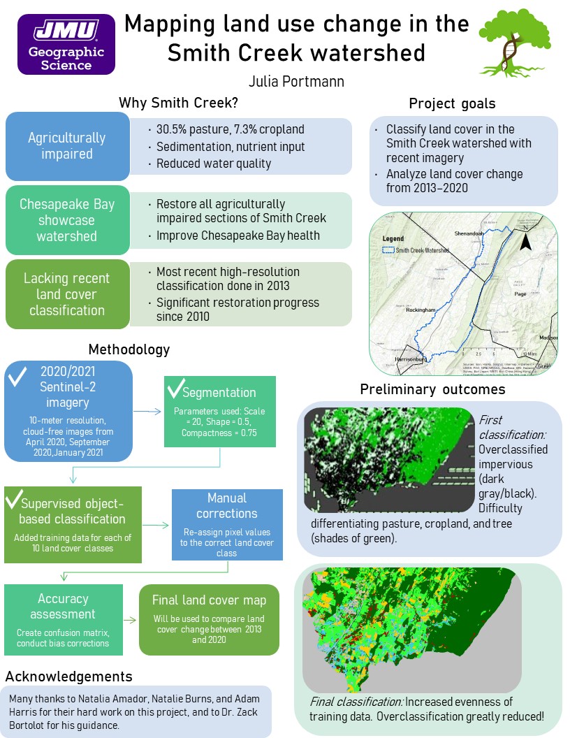
In collaboration with undergraduate students in the Geographic Science department, I have been using remote sensing techniques to conduct a high-resolution land cover classification of the Smith Creek watershed using up-to-date imagery. Smith Creek was declared a showcase watershed for the Chesapeake Bay by the United States Department of Agriculture in 2010, and has had widespread stream restoration conducted over the past 11 years. However, the most recent high-resolution land cover classification was conducted using 2013/2014 imagery, and therefore will not capture the remarkable work that has been conducted since 2010. Using ArcGIS Pro (Esri) and PCI Geomatica 2017, we have been conducting a land cover classification using 2020 and 2021 imagery from the Sentinel-2 satellite. Currently, we are conducting manual corrections on our final supervised object-based classification, then will calculate several accuracy assessment metrics. With the final land cover classification, we will calculate the percent change in agriculture (pasture+cropland) and in tree cover throughout the watershed between the 2013/2014 assessment and the 2020/2021 assessment. These results will provide an interesting evaluation of restoration progress throughout the watershed and inform restoration practitioners on where additional efforts should be allocated.
Harrisonburg, Virginia 22807
Mon - Fri:
8 a.m. - 12 p.m. &
1 p.m. - 5 p.m.
Closed 12 p.m. - 1 p.m. for lunch