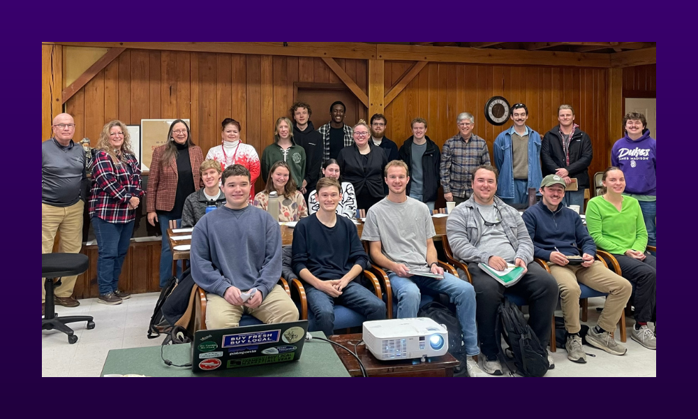
Geography students and Dr. Carole Nash present their research findings to Mount Crawford town officials, supporting the town’s historic district nomination.
SUMMARY: Through archival research, interviews and spatial analysis, Geography students help document Mount Crawford's history and provide context for a National Register of Historic Places nomination.
As Mount Crawford, Virginia approached its 200th anniversary, town leaders focused not only on celebrating the past but also on preserving it and planning for the future.
One of the town’s primary goals was pursuing designation on the National Register of Historic Places through the creation of a historic district, an effort that requires both documentation and historical context.
But identifying historic structures is only part of the process.
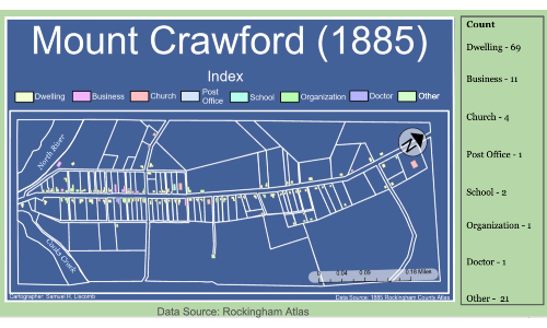
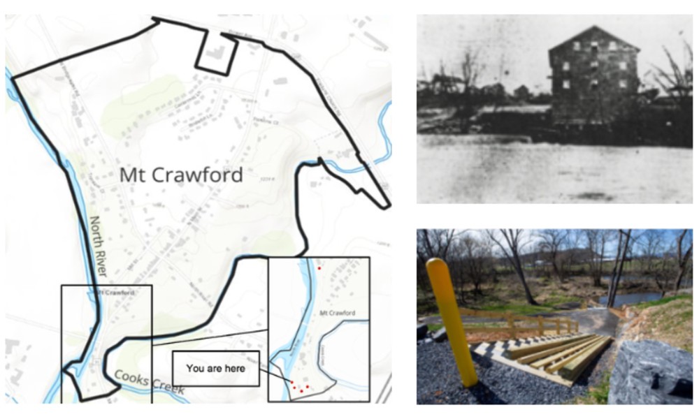
Building use in Mount Crawford, Virginia, in 1885.
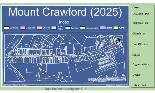
The 2025 map illustrates changes in building use over the past 140 years.
Nash, who is also an archaeologist, worked with Libby Clark, the town manager of Mount Crawford, to secure a grant from the Virginia Department of Historic Resources. The funding allowed an architectural firm, Hill Studio, to survey the town and prepare the nomination.
“We have houses that are actually log structures, but now have been covered with vinyl,” said Libby Clark, town manager of Mount Crawford. “Designating and protecting these homes that are a hundred or two hundred years old helps preserve that history.”
The designation could also allow property owners to access tax credits for restoration, offering “a great incentive” for those who choose to preserve historic properties.
At the same time, Nash incorporated the project into her Geography 415: Environment, Landscape and Culture, giving 18 students an opportunity to contribute to the effort. “The idea behind the class is that if you’re trying to understand what a community is like today, you have to understand the history of the environment and geographic setting,” Nash said. “You have to understand the place.”
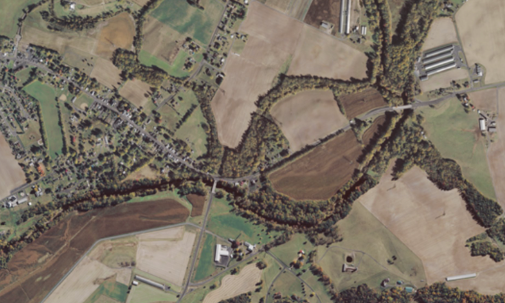
Mount Crawford developed at the confluence of the North River and Cooks Creek, where waterways supported mills, trade and migration. While it boosted the economy, it also introduced flood risks and ecological challenges.
Students in the course come from two geography concentrations: an environmentally focused track and the Geographic Information Systems track. That background shapes how they approach their research. “As geographers, they are thinking about this problem in a very spatial way,” Nash said. “They’re thinking about how things fit together.”
That means looking beyond individual features to understand connections across the landscape, from the North River watershed to transportation routes like Route 11, and how those systems link Mount Crawford to surrounding communities. Students applied mapmaking, research, and new archival skills to bring those relationships into focus.
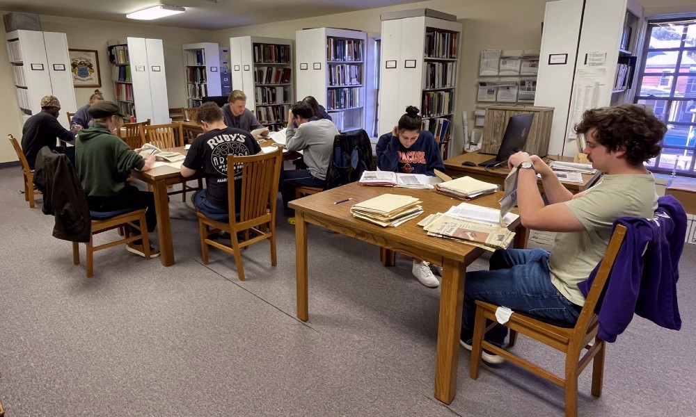
Working in teams, students interviewed residents, conducted archival research, and developed reports to help build context for the historic district nomination. Their projects examined the North River, the natural environment, land development, transportation systems and community life. For many, the experience introduced new research methods.
<Geography students conducting research at Rocktown History in Dayton, VA.
Kitts focused her research on the role of religion in the community to understand how churches contribute to local life. “This was my first class where I really had to interview people, come up with the research questions and have face-to-face conversations,” said Reagan Kitts, a geography major.
Other students focused on development and how the town has changed over time.
Ryan Crowe, a geography major, analyzed patterns of development using satellite imagery, planning documents, and interviewing local stakeholders. “There are so many stakeholders who have a say in how Mount Crawford develops: property owners, the town council, developers and residents,” Crowe said. At the same time, many residents are focused on preserving the town’s identity. “People are very connected to their history there, and they don’t want things to change.”
The project emphasized gathering perspectives and identifying patterns rather than providing a single outcome.
At the end of the semester, students presented their findings to Clark, members of the town council, and other community stakeholders. They revised their work based on feedback before submitting final reports.
Clark learned a lot from the students’ research. “Hearing the whole history, from how the town’s evolved to where it fits in today and where we could be, was really interesting,” Clark said. “The students really helped provide a history of the town from a third-party perspective.”
For students, the project provided an opportunity to apply their coursework in a real-world setting. “If we weren’t doing this, we’d be sitting in a classroom talking about it,” Crowe said. “This lets you actually work with people who are dealing with these issues in real time.”
For generations, the North River shaped life in Mount Crawford. In the early 1800s, it powered mills, supported farmland and carried goods to larger markets, making the crossing a hub for trade and travel and leading to the town’s charter in 1825. While its uses have evolved, the river’s impact remains visible today, and the new river walk will reconnect the community to the waterway that helped build the town.
“This part of Virginia is very history-rich, and there’s so much to learn from the communities around us,” Kitts added. “It’s important to get connected with the community.”
For Nash, the project reflects a broader role the university can play in the community. “We sometimes forget the power that the university has, not just in our resources, but in the incredible skills that our faculty and students have,” she said. “These small towns are living, breathing communities with complex challenges.”
“I want our students to know about this place,” she said. “I want them to understand what it means to be at a university like this, in a rural area, and the impact that we have.”
As Mount Crawford moves forward following its bicentennial, the students’ work was incorporated into the historic district nomination and will provide a foundation for future planning efforts.