
JMU and NOAA team up for turtle research
ISAT, GS students create app to track loggerheads
JMU News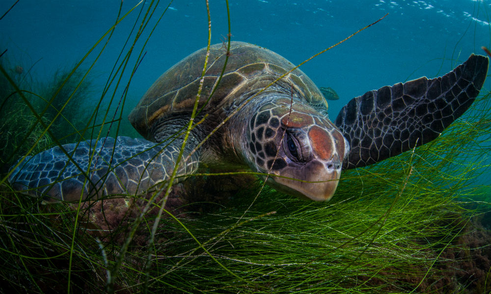
SUMMARY: Recent changes to water temperatures have led to increasing numbers of loggerhead sightings along the Southern California coast. Through a collaboration between JMU and NOAA, JMU students are helping NOAA improve their data collection methods to better protect this endangered species.
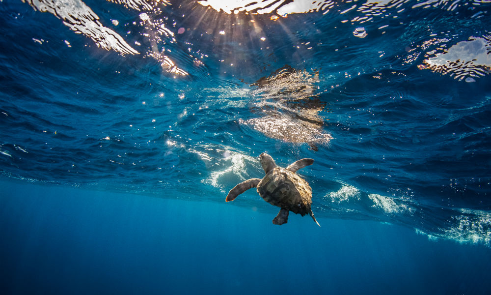
In 2011, loggerhead sea turtles were listed as an endangered species in the North Pacific - a decline from being labeled a “threatened” species since 1978. According to National Geographic, this is the result of factors like overdevelopment of nesting areas, pollution, and shrimp fishing. Conservation organizations like the National Oceanic and Atmospheric Administration (NOAA) collect data on turtle sightings to track the species. Recent changes to water temperatures, however, have led to increasing numbers of loggerhead sightings along the Southern California coast. Through a collaboration between JMU and NOAA, ISAT student Olivia Ceppi (‘16), with the assistance of GS students Mark Kluck (‘18) and Collin Riley (‘18), is helping NOAA improve their data collection methods to better protect this endangered species.
As an avid scuba diver, Ceppi knew from the start that she wanted to focus her capstone project on marine ecology. With help from her advisor, Joy Ferenbaugh, Ceppi was able to connect with Jeffrey Seminoff from NOAA’s Southwest Fisheries Science Center in Southern California. Seminoff, the program leader for the Marine Turtle Ecology and Assessment Program, offered Ceppi the opportunity to help with their recent project collecting data on the loggerhead turtles. “Part of NOAA’s mission is to engage with academics, provide mentorship opportunities, and give students the chance to work alongside NOAA scientists,” explained Seminoff. “This project is right in the realm of what we do, so we were happy to collaborate.”
 Loggerheads are among five endangered species of sea turtles that NOAA has worked to learn more about and protect. While the loggerheads in the North Pacific typically remain in the warmer waters around the Baja California Peninsula region of Mexico, in recent years there have been increased sightings of loggerheads around the coastal areas of Southern California known as the ‘Bight’. “We have been in a two year El Niño, which has compounded with a warmer period of Pacific Decadal Oscillation (PDO) oceanic cycles, causing a double whammy of warm waters,” explained Seminoff. “Because of this shift, there have been an unprecedented number of turtle sightings in the past year.”
This has given the National Oceanic and Atmospheric Administration (NOAA) a unique opportunity to collect additional information on these turtles. “The thing with loggerheads and other sea turtles is that they hatch, they swim out into the ocean, and we don’t see them again until they show back up on the beach as adults to lay eggs, so there’s a gap in our knowledge about the turtles” said Ferenbaugh. “These recent sightings give us a chance to better learn what’s going on with the turtles, which is really important for conservation work.
Ceppi initially began working on the project intending to work with NOAA’s current loggerhead data, but found that she could more directly help NOAA by improving their data collection methods. Currently, one of the ways NOAA gathers their data is through citizen scientists reporting turtle sightings via phone and email hotlines. This system can be cumbersome, as all the submissions must be manually plugged into NOAA’s system. “The current process is also very broad, so the type of data NOAA receives ranges from very specific to general statements about turtle sightings,” explained Ceppi. “We decided that we should create an app for NOAA that would streamline the process and gather more consistent data.”
To accomplish this, Ceppi and Ferenbaugh contacted Paul Rittenhouse and his GS students, Kluck and Riley, who then built a GeoForm application with ESRI’s ArcGIS Online and desktop software. With the new app, users can quickly fill out an electronic form with their demographic information and what they saw, are able to add photos they took from their phones, and geotag their location using GPS. “By guiding people who are reporting data, the hope is that the app improves the validity and reliability of the data,” explained Rittenhouse. “From a social science position, the app allows greater consistency, and gives that spatial component with geotagging.”
The app will also greatly reduce the amount of time taken to input data, and hopefully encourage more people to submit their turtle sightings. “When people submit the form, the app automatically updates the maps,” said Kluck. “This will make the data much easier to analyze and visualize for NOAA.” A prototype for the app is currently completed, and the team hopes to officially release the app within the next few months. Ceppi will then use a month’s worth of new data to complete her capstone project about the turtle sightings.
After Ceppi completes her Capstone, JMU and NOAA hope to continue their partnership, with opportunities for other students to use the data, maintain or improve the app, or possibly have internships with NOAA’s office in Southern California. “I’ve been doing research on turtles for over 30 years, and worked on a lot of fascinating projects, but the new presence of loggerheads has been a game changer,” said Seminoff. “This app that the students have worked on has truly been the icing on the cake for NOAA.”