
Environmental Soil Sampling and Analysis: Application in Supporting Sustainable Land Use Practices in Areas Impacted by Explosive Ordnance
By Bui Doan Bach, Kimberley McCosker [ Norwegian People’s Aid ], and Linsey Cottrell [ Conflict and Environment Observatory ]
CISR Journal
This article is brought to you by the Center for International Stabilization and Recovery (CISR) from issue 25.3 of The Journal of Conventional Weapons Destruction available on the JMU Scholarly Commons and Issuu.com.
Assessing the humanitarian impact of explosive ordnance (EO) has been an integral part of the land release process for decades. However, rarely have environmental aspects been included, despite the fact that EO can impact the environment in several ways, adding to the overall humanitarian impact of the use of explosives.
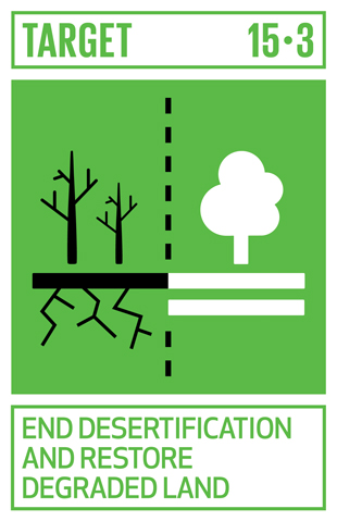
EO can damage vegetation and cause soil degradation and compaction when it explodes, consequently destroying the soil structure, reducing soil stability, and reducing soil fertility.1 While there are many human activities that degrade soil, such as intense agriculture, deforestation, overgrazing, and loss of cover vegetation, conflict-affected areas are typically highly vulnerable due to several factors. Soil is a precious resource, and soil health is essential to food security, sustainable livelihoods, and well-functioning ecosystems. Degraded soils lose their capacity to store water, nutrients, and carbon, and to support important soil microbes. In Syria, vegetation change and soil erosion are among the most serious environmental issues associated with the conflict.2 The UN Sustainable Development Goal (SDG) 15 Life on Land includes the aim to halt and reverse land degradation and is a key enabler for many other SDGs.
The use of mechanical equipment such as flails, tillers, or rollers to clear land of explosive remnants can also adversely impact soils due to the loss of soil structure, erosion, and compaction.3 Mechanical clearance has the potential to cause significant environmental impacts; IMAS 07.13 encourages minimizing the area subject to the use of mechanical techniques through well-targeted survey and clearance operations.4 Measures to minimize the adverse effects from mechanical clearance include avoiding clearance activities during heavy rainfall or strong winds, and reducing the number and size of areas exposed at any one time.5
EO itself is also a potential source of chemical contamination. This includes the energetic material as well as other munition components such as metals (e.g., antimony, chromium, lead, mercury, and zinc). Although the environmental impact of a single denotation of an individual munition item is likely to be minor, multiple denotations or munition disposal activities could lead to elevated levels of contaminants in the environment.6 Degrading over time, EO causes hazardous chemicals to leach into the ground or water as casings corrode. Pollution caused by EO can persist and present long-term risks to people and the environment for many years after the conflict has ended. The level of risk will depend on the nature and extent of the pollution (or contaminants) present, the local environment, the sensitivity of the environs, and how the impacted area is accessed and used.
In some conflict settings, the sources of chemical contamination may be a result of direct damage of infrastructure, or from the use of particular weapons.7 The tons of debris that can be generated by conflict in urban areas present many risks and challenges, including the potential exposure to harmful chemicals and hazardous materials, such as asbestos. The widespread use of defoliants by the United States during the Vietnam War such as Agent Orange, which contained the highly toxic dioxin 2,3,7,8 TCDD, has also left a legacy of exposure risk, including polluted soil and water, leading to some contaminated food chains8 more than forty years after the end of the conflict.
The nature and significance of the environmental impacts from the use of EO will vary considerably between settings. When quantifying the potential risk to either the environment, people who access the area, or how ground conditions may influence future use of the area, it is important that mine action actors understand the baseline state of the existing environment.
Quantifying Potential Environmental Impacts and Risks
Few studies have been carried out within conflict-affected settings to assess the impact of EO on land quality and the impact on soil productivity. A pilot study in Vietnam, funded by the Norwegian Ministry of Foreign Affairs (see pilot study), has been undertaken to develop tools and procedures to assess such impacts, and to help inform decisions on the suitability for future land use and agriculture. Soil degradation is an escalating environmental risk9 and a critical consideration during the land release process as land use pressures increase.
Soil degradation involves a number of processes including erosion by wind and water, salinization, and pollution. Soil organic content can be a useful indicator of soil health and was used as an indicator in the pilot study. This is because of its association with nutrient cycling as well as water infiltration, soil biodiversity, vulnerability to erosion, and crop yields or productivity.
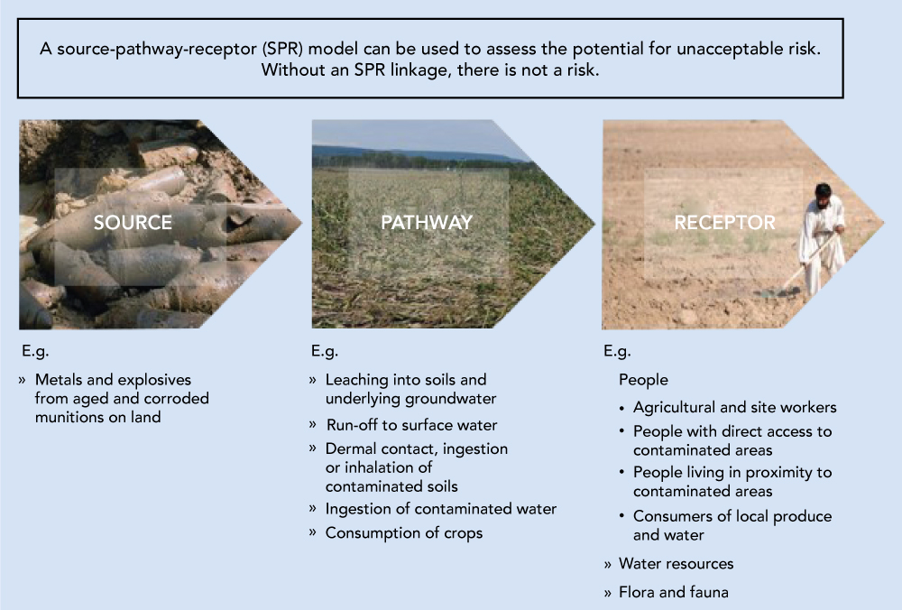
Contaminants—which may accumulate and persist in the ground due to the presence, use, or disposal of EO—have the potential to affect human health and may migrate to underlying groundwater or nearby surface water. The source-pathway-receptor (SPR) model (see Figure 2) can be used to understand and assess the environmental risks from suspected or confirmed contamination. For a source (or contaminant) to present a risk to a receptor, they must be linked by an exposure pathway. Receptors could be people, crops, grazing livestock, surface water, groundwater, flora and fauna, or buildings and buried infrastructure.
Where there is a viable pollutant linkage, appropriate sampling and analysis of soil and water will provide a better understanding, help quantify the risks, and decide whether risks are unacceptable. If the risk is unacceptable or uncertain, remediation or corrective action may be needed to manage or reduce the risk. Investigations and the collection of samples are typically phased, with the information from the initial or preliminary sampling and analysis used to inform the design of further investigations, if deemed necessary.
When developing a soil sampling and analysis strategy, it is important to understand the history of the area under investigation to ensure that sources of potential contamination are not overlooked. In some cases, this may include sources of contamination not directly linked to the conflict itself. This should form part of the non-technical survey (NTS) and be used to establish the nature and possible areas of contamination, and support development of a SPR model for the site.
Pilot Study: Vietnam
Study Area and Methodology
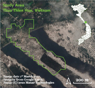
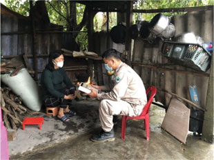
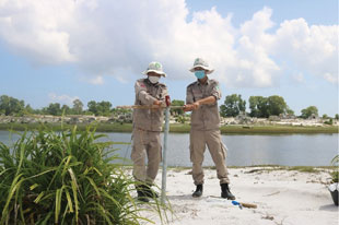
The pilot study was carried out by Norwegian People’s Aid (NPA) in Vietnam, in collaboration with the Institute of Resources and Environment (IREN) at Hue University and the Union of Friendship Organization in Thua Thien Hue Province (see Figure 3). The study site is located in Luong Mai Village in the coastal sandy area of Phong Dien District, Thua Thien Hue Province in Central Vietnam.
Historically, Luong Mai Village was a United States’ defensive location, and multiple bunkers can still be found in the village. NPA’s cluster munition remnants survey identified one confirmed hazardous area in Luong Mai Village, covering 259,770 m2. Clearance of the study site started in January 2018. In 12 months, 271 EO items were found, including 210 cluster munition remnants, 29 grenades, 26 mortars, 3 projectiles, 2 TNT rounds, and 1 rocket.
To date, there has been limited research done in Vietnam to specifically look at the potential impacts of heavy metals from munitions impacting agricultural soils or the surrounding environment. Anecdotal reports from local farmers had suggested lower crop yields within areas impacted by EO, with a concern that soil quality was affected. Lower crop yields may be due to a combination of factors including soil structure, soil nutrient and organic content, moisture content, and salinity as well as the potential presence of elevated concentrations of contaminants.
The project aimed to assess the soil conditions within the study area, determine the presence and potential environmental impact of heavy metals, consider farming options, and develop recommendations to improve land use practices. The final results of the pilot study will also be shared with the community to communicate potential risks, explain how any unacceptable risks could be managed, and provide recommendations on how the land may be cultivated or used.
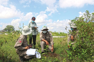
of the NPA NTS team were trained to collect soil samples from areas with known contamination from EO. IREN carried out the laboratory analysis of soil samples for metals and other soil parameters (see Table 1).
| Soil test category | Parameter |
|
General |
pH, dried soil mass, particle size, |
|
Nutrients |
total nitrogen, total phosphorus, |
|
Contaminants - metals |
arsenic, cadmium, copper, lead, zinc |
The study area was divided into a 50-m-by-50-m grid, with a total of 60 soil samples collected at varying depths from 20 grid locations following a standardized sampling methodology. Sample location data was recorded using GPS and NPA’s existing information management systems for NTS. The methodology was considered by the NPA team to be straightforward and could be replicated in other areas, where necessary.
The NPA NTS team also interviewed people from one hundred households in Luong Mai Village to understand their needs and current practices, specifically relating to current use of land, agricultural opportunities, and challenges. Economic pressures mean that cultivation was already planned for the area from where the samples were collected, in spite of the sandy conditions and concern about the potential for soil contaminants to be present. Cultivation plans primarily included growing peanuts, cassava, and yams, plus low-value forestry such as acacia trees and some livestock grazing and poultry. Knowledge of soil conditions and adoption of practices to ensure safe, viable, and sustainable land use is therefore important.
Study and Area-Wide Characteristics
Forest and vegetation cover across the country was heavily impacted by both the French colonial war and conflicts during the 1960s and 1970s. Defoliant spraying alone was estimated to have destroyed over two million hectares of Vietnam’s forests by 1971.11 While there is no evidence that the pilot study area was subject to spraying by defoliants, the area is located in Thua Thien Hue Province, which was also one of twelve provinces most heavily sprayed with the defoliant Agent Orange during the war.12
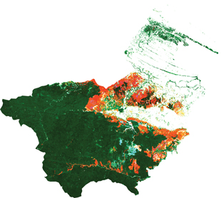
In spite of forest recovery across some parts of Vietnam, open source data on tree cover for the study area’s Phong Dien District indicates an estimated 19.8 percent loss of tree cover across the district from 2000 to 2020 (see Figure 4). Interviews with the local community have highlighted their concerns about forest decline, which had been previously relied upon for local livelihoods.
The pilot study area itself is part of a sandbar, which stretches approximately 50 km, with sparse tree cover and the area impacted by wind-driven erosion and sand encroachment. Agriculture is already challenging due to climatic, soil, and hydraulic conditions, with most farmers relying on pesticide and herbicide use.
Results
Unsurprisingly, the results of the soil sampling and analysis carried out confirmed sandy and acidic soil conditions. Acidic soil can increase the mobility and bioavailability of certain metals, including copper and zinc. The soil organic content (on average less than 1.3 percent) and nutrient levels were also low, indicating that soil improvements would be needed to support planting and agriculture in the area.
In this case, the results from the grid sampling and soil analysis for metals did not indicate the widespread presence of elevated concentrations of arsenic, copper, lead, or zinc. Arsenic and copper were not recorded above laboratory detection limits, and the recorded concentrations for lead and zinc generally did not exceed the soil guideline value for agricultural soils. An elevated zinc concentration was detected in only one sample analyzed.13 The highest concentration for lead was also recorded in this same sample, although the comparable soil guideline value was not exceeded. The average cation exchange capacity (CEC) recorded in the soil samples analyzed (8 meq/100 g) and low organic content indicates that soils within the study area are more susceptible to leaching. This means the potential loss of nutrients, as well as leaching of metal contaminants from soils. This pilot project was developed to trial the sampling methodology and assessment protocol ahead of refinement and adoption on other sites, where EO has potentially impacted land quality; however, the results from this pilot study are site-specific and will not be indicative of soil conditions or contamination across other EO impacted sites. The nature, condition, and planned end-use of sites vary considerably. NPA aspires to critique and apply the methodology across more sites, subject to funding and resources constraints.
Information from the NPA interviews with local farmers, together with results from the soil sampling, helped IREN assess future land use options and develop recommendations for optimizing sustainable land use practices. These include planting with native species like melaleuca. Melaleuca is a perennial plant with high tolerance to drought and waterlogging. It also produces an essential oil, which has a commercial value.
Next Steps
The pilot project has been successful in developing survey and sampling methodologies, as well as the IREN partnership. In this case, the initial results of the pilot project do not indicate widespread elevated concentrations of metals present in soils.
Additional research is planned, including clarifying other potential sources of chemical contamination through community surveys and data collection. Combined with the soil laboratory results, this will help inform a realistic recommendation for optimizing land use and promoting sustainable land management. The results of the project will be shared with Luong Mai Village and specifically the land owners, through a number of reports, digital soil maps, and community training sessions. Further work with IREN is planned and may include exploring the implementation of nature-based solutions, such as selective planting to improve and restore soil quality, and introducing soil stabilization techniques. This will conclude the first phase of the project.
Further soil sampling and analysis is also planned to provide an increased sampling density and target other potential sources of contamination—for example in proximity to certain recorded EO finds. More specific methodologies will be discussed and tested by NPA and IREN, including the collection of samples from directly beneath larger EO prior to demolitions, and testing across different soils and terrains. The overall objective will be to better predict the level of risk to human health and the wider environment from long-term EO contamination and potentially impacted soils in central Vietnam. This may lead to the need to prioritize certain clearance tasks and provide additional support to communities before, during, and after clearance takes place. NPA and IREN welcome further discussion with sector partners on the potential direction that future phases of the project could take.
NPA is also developing a pilot standard operating procedure for a “Total Mine Action Survey’ to further integrate environmental protection with mine action activities. This methodology will combine NPA’s proven NTS approach with environmental survey and response, as well as identification of victims of EO and their needs, and provision of EO risk education, environmental awareness, and climate risk education. There is potential to include soil sampling into this new methodology, which will be piloted in late 2022. This will include considering possible soil screening or rapid measurement techniques, since the cost of laboratory analysis is prohibitive and falls outside the scope of traditional mine action grants. An immediate goal is to seek alternative sources of funding for the technical aspects of this project to enable a second phase of this important work to continue.
Adopting Sampling Programs and Important Considerations
Information collected as part of community engagement and the NTS is a key element of the baseline environmental data needed to support environmental assessment strategies and sampling programs. The NPA/IREN study in Vietnam has been an important exercise to pilot the methodology and develop assessment strategies. In adopting a similar sampling and assessment strategy, key considerations include
Baseline knowledge of the soils present within the study area and an understanding of how these fit with the wider landscape.
Identification of potential sources of chemical contamination, including explosive remnants of war but also other sources from current or historic land use practices, waste disposal, fires/burning practices, pollution from nearby industrial sources, or from the deposition of airborne contaminants.
Understanding of the environmental setting of the study area (e.g., groundwater regime, surface water features, local flora and fauna) and current land use.
- Development of a SPR model where there is potential for soil contaminants to be present.
- Design of a sampling and testing strategy that provides good coverage of the study area and site, and adequately characterizes site conditions.
- Knowledge of any planned land use and whether land will be fit-for-purpose.
- Use of appropriate assessment criteria to evaluate the soil conditions and risks that meet the overall objectives of the study assessment.
- Development of appropriate sustainable soil management, ecological restoration, conservation, and land-use practices or control measures relevant to the site conditions and risks, in consultation with the local community.
- Communication of study findings to the local community and other stakeholders, including the level of any risk and how these will be managed.
The partnership between NPA and IREN, and support provided by the Norwegian Government, has been invaluable in developing and implementing this pilot study. The ability to carry out sampling and assessment programs by humanitarian mine action organizations will rely in part on such specialist support and the expertise of partners. The pilot study has been critical in developing the tools that can be adopted and applied across other sites and support communities. ◊
 Bui Doan Bach
Environment Protection Officer
Norwegian People’s Aid
Bui Doan Bach is an Environment Protection Officer for NPA in Vietnam, working on reducing the environmental impact of mine action, and promoting climate change mitigation and adaptation measures in operational areas. Before joining NPA, Bach was a project officer for an NGO, coordinating and undertaking projects funded by USAID, UNDP, and IUCN on developing local solid waste management capacity. He has also provided advice on Corporate Social Responsibility (CSR).
 Kimberley McCosker
Project Manager
Norwegian People’s Aid
Kimberley McCosker is a Project Manager for NPA in Vietnam. Since joining NPA, her work has included strategic management of environment and gender mainstreaming activities, capacity development of national and provincial authorities, program management support, and monitoring and evaluation of operations and projects. McCosker is currently pursuing a Master of Environmental Management and Development at the Australian National University.
 Linsey Cottrell
Environment Protection Officer
Conflict and Environment Observatory
Linsey Cottrell is the Environmental Policy Officer at the UK-based charity, the Conflict and Environment Observatory (CEOBS). Cottrell is a Chartered Environmentalist and registered in the UK as a Specialist in Land Condition. She was also a trustee for the Institution of Environmental Sciences from 2016–2022. Before joining CEOBS in 2019, she worked in the environmental consultancy sector on contaminated land and environmental risk assessment.