
At James Madison University, we define civic engagement as advancing the legacy of James Madison, the “Father of the Constitution,” by preparing individuals to be active and responsible participants in a representative democracy dedicated to the common good. As philanthropist David Rubenstein noted in a speech on Constitution Day 2018 at JMU, as the university named for the “Father of the Constitution,” we “have a special obligation to know something about the Constitution” and our namesake because “people who are more knowledgeable about our government, more knowledgeable about our Constitution, probably are going to be better citizens, vote more intelligently and be more engaged in our country."
Brief Essay
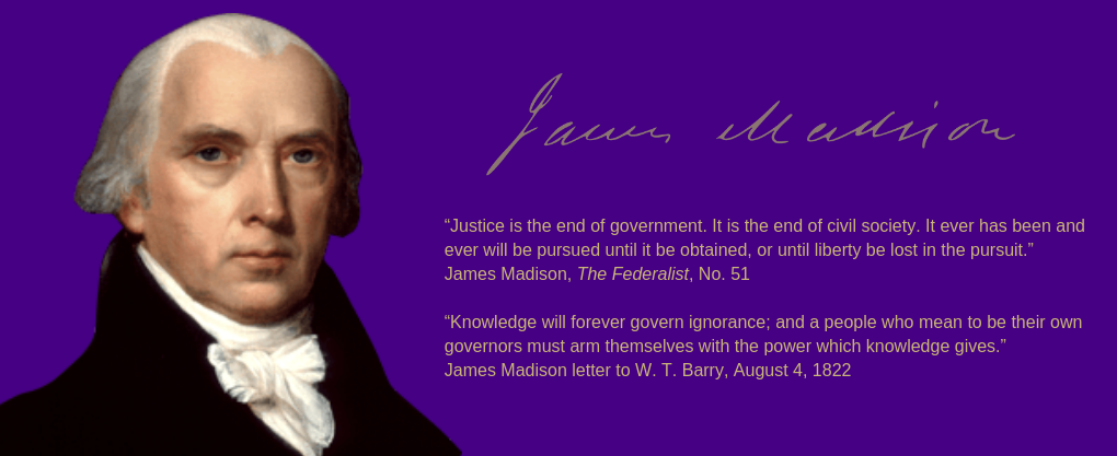
James Madison was born at Belle Grove plantation in Port Conway, Virginia on March 16, 1751. A diligent and dedicated public servant, among Madison’s key achievements were: supporting the Virginia Declaration of Rights and the Virginia Statute for Religious Freedom; helping to produce the Constitution of the United States of America and authoring the Bill of Rights; collaborating with Alexander Hamilton and John Jay on the Federalist Papers; leading the Democratic-Republican Party; serving as Secretary of State; becoming the fourth president of the United States; and serving as commander-in-chief in the War of 1812 (and the only president to lead troops in battle while in office). A respected leader, Madison was known for his brilliant persistence in politics, careful preparation and hard work.
During his childhood, Madison had a host of privileges many lacked during this time. From the ages of 11 to 16, he was taught subjects ranging from mathematics, to geography, to Latin. His studies led him on a journey of fascination with ancient philosophy that would inform his ideas about democracy. In 1769, Madison enrolled in the College of New Jersey, now known as Princeton University. Graduating in 1771, and longing for further education, Madison became the College of New Jersey’s first graduate student.
After completing graduate studies, Madison returned home and became involved in local politics, serving as a member of the Orange County Committee of Public Safety in 1774. In 1776, he was elected to the Virginia Legislature. While serving in the state legislature, Madison began forging a relationship with Thomas Jefferson, a young innovative mind in Virginia at the time. That same year, at the age of twenty-five, Madison fought to amend the Virginia Declaration of Rights to ground religious liberty in natural rights, not permission of the state. Madison’s principle of “free exercise” of religion was enacted into law ten years later in the Virginia Statute for Religious Freedom, written by Jefferson, but pushed by Madison through the General Assembly.
In 1780, Madison was chosen to represent Virginia in the Continental Congress (1780-83 and 1786-88). Although the youngest delegate, he played a major role in the deliberations of that body. Over time, the weaknesses of the Articles of Confederation, the governing national document at the time, were exposed, and Madison believed the document lacked structure to adequately serve the new democracy. Madison also grew increasingly displeased with state legislatures and perceived that they too often pandered to the whims of their constituents at an unsustainable rate.
Madison was the main author of the Virginia Plan, a radical departure from the Articles of Confederation. Drawing on Charles Secondat, Baron de Montesquieu’s theory of the separation of powers, the Virginia Plan proposed to the Constitutional Convention a three-branch national government elevated over the states but grounded in the sovereignty of the people. The heart of the proposed national government was a bicameral legislature, with the lower house apportioned according to some combination of wealth and population and elected by the people, and an upper chamber elected by the lower house from a list of candidates nominated by the states. The second branch was a national judiciary of “one or more supreme tribunals,” and various “inferior tribunals” appointed with life tenure by the legislature. The Virginia Plan also included a vaguely defined “national executive” “to be chosen by the National Legislature for a term of _____ years.” Madison’s ideas also innovated the theory of separation of powers by mixing and sharing powers among the branches of the national government to ensure accountability across entities.
While much of the Virginia Plan was accepted by the Committee of the Whole at the Constitutional Convention, many compromises were also made to reach consensus (such as questions on representation of states in Congress) and to fill in details (such as the power and configuration of the executive). With regards to representation, one of the key questions revolved around the issue of slavery. In a speech at the Constitutional Convention, Madison stated that “the greatest division of interests in the United States…lay between the northern and southern.” To save the framework of the Virginia Plan, Madison proposed a “compromise” on representation in the legislature that would give proportional representation to one chamber, slaves included, and representation based only on the number of free inhabitants to the other chamber. Madison explained, “By this arrangement the southern [states] would have the advantage in one house, and the northern in the other.” Ultimately, the state delegates to the Convention agreed on a “compromise” proposed by James Wilson and Roger Sherman to include a clause in Article 1, Section 2 of the Constitution that counted three out of every five slaves as a person for purposes of taxation and representation, thus giving disproportionate representation to slaveholder interests in the House of Representatives until the Civil War.
While Madison has been called the “Father of the Constitution,” he himself noted in a letter to William Cogswell in 1834 that the Constitution “was not, like the fabled Goddess of Wisdom, the offspring of a single brain. It ought to be regarded as the work of many heads and many hands.” Indeed, there were many others who made essential contributions to its content, ratification and ideas for the first and most important amendments. But, Madison played a central role in all of the stages - from the Constitution’s drafting, to arguing and explaining the Constitution in The Federalist Papers, and to sorting proposals that would become something like the first ten amendments (after being persuaded by Jefferson to accept the idea of a Bill of Rights). Not only did Madison help shape the Constitution, he was also the first historian of the Constitutional Convention. Madison’s notes from the Convention were the most complete set left by any delegate.
Once the Constitution was drafted and awaiting ratification by the states, Madison, John Jay and Alexander Hamilton wrote The Federalist Papers urging citizens, especially in New York, to ratify the new Constitution and explaining how the government would function under it. The Federalist papers are still considered some of the most innovative and impactful tenets of American political philosophy to date.
Madison authored 29 of the 85 essays. In The Federalist No. 49, Madison eloquently explicated the idea of popular sovereignty by which “The people are the only legitimate fountain of power, and it is from them that the constitutional charter, under which the several branches of government hold their power, is derived.” His essays also explained how a compound republic and complex federal system would preserve individual rights and buttress liberty by “extending the sphere” to “take a greater variety of parties and interest,” thereby making ambition check ambition. “Liberty is to faction what air is to fire, an aliment without which it instantly expires,” Madison wrote in The Federalist No. 10. He continued, “But it could not be less folly to abolish liberty, which is essential to political life, because it nourishes faction, than it would be to wish the annihilation of air, which is essential to animal life, because it imparts to fire its destructive agency.” Madison also authored The Federalist No. 54, which was an effort to justify the three-fifths rule for counting slaves in the formulation for representation in the lower chamber of Congress. In the paper, Madison claims to be persuaded by the arguments of “one of our Southern Brethren,” that slaves are both “irrational animals, which fall under the legal denomination of property,” but are also “moral persons” under the law. The three-fifths rule, therefore reflects their “mixed character of persons and of property.”
Madison had argued in The Federalist Papers that the size of the United States and complexity of the federal system would uphold liberty and make it difficult for factions to seize power. However, after ratification, Madison came to believe that in addition to the structural arrangements in the Constitution, another guarantee was necessary. In 1791, he argued that enlightened public opinion would thwart threats to liberty. He wrote in the “Popular Basis of Political Authority” that “public opinion sets bounds to every government, and is the real sovereign in every free one.”
In the early 1790s, Madison helped found America’s first political party, the Democratic-Republicans. Madison viewed politics as essentially partisan and stated in a speech to the Constitutional Convention on the Right of Suffrage: “No free country has ever been without parties, which are a natural offspring of freedom.” Indeed, he observed later in a letter to Henry Lee that, “The Constitution itself … must be an unfailing source of party distinctions.” Following from his interest in freedom of the press and “enlightening” public opinion, Madison also helped found the first party newspaper, the National Gazette, which analyzed and criticized issues and personalities all with an ideological ax to grind, much like FoxNews, MSNBC, The Nation or The New Republic today. Madison also regularly penned articles to analyze and deconstruct issues and to attack political personalities with whom he and Jefferson disagreed.
Madison served in Congress during the presidency of George Washington and was the chief supporter of his policies and agenda. Despite originally opposing a Bill of Rights in the Constitution because he believed an enumeration of rights was not a sufficient barrier to government encroachments on individual liberty, Madison’s most notable accomplishment in Congress was the introduction and guiding to passage of the first ten amendments to the Constitution. Ratified in 1791, the Bill of Rights codified constitutional protections for what Jefferson and Madison viewed as fundamental human and civil rights, including religious liberty, freedom of speech, and due process, and rights against unreasonable, unsupported, or impulsive governmental authority. Madison also led the fight in Congress against the Alien and Sedition Acts, which attempted to suppress opposition to a Federalist foreign policy that favored England over France, and were viewed by Democratic-Republicans as fundamental violations of the Bill of Rights.
When Thomas Jefferson was elected president, he appointed James Madison as Secretary of State. Perhaps most notably in this position, Madison helped negotiate the Louisiana Purchase, which doubled the size of U.S. territory.
Madison was elected president of the United States in 1808. On June 1, 1812, Madison urged Congress to declare war against Great Britain, the first war message by an American president, somewhat an irony given that Madison feared and wrote about war as the enemy of liberty and preferred trade war as his policy instrument of choice (see the Pacificus-Helvidius Debates). At issue in 1812 was evidence that the British were supplying arms to American Indians, who were angered by settlers encroaching on tribal lands in the Michigan and Indiana territories; by British seizures of American ships; and by the British seeking to acquire additional territory in Canada and Spanish Florida.
Once a staunch opponent of Alexander Hamilton’s plans for a national bank, Madison discovered in war the limitations of the principles of states’ rights, and in his seventh annual message in December 1815 recommended several measures, including chartering the Second Bank of the United States. The Democratic-Republicans had allowed the first bank to expire in 1811 and with no national bank during the War of 1812, the federal government lacked a source of currency that exacerbated a financial crisis. Believing that a national bank was a necessary evil, he signed the bank bill into law in 1816.
After the presidency, Madison retired to his home at Montpelier. Madison also advised Jefferson on the founding of the University of Virginia, served on its Board of Visitors and succeeded Jefferson as rector of the university in 1826.
James Madison was at the center of American constitutionalism. Perhaps more importantly, he was at the center of the birth of American politics, which is what made constitutionalism work. As the leader of a party and partisan press, as a dedicated public servant for more than 40 years, we can learn from Madison’s contributions to democratic theory, to politics and to governance.
Quick Facts
Birth: March 16, 1751
Death: June 28, 1836
Birth Place: Port Conway, VA
Education: College of New Jersey (now Princeton University) graduated 1771
Religion: Episcopalian
Career: Politician, Planter
Political Party: Democratic-Republican
Nickname: “Father of the Constitution”
Marriage: September 15, 1794 to Dolley Payne Todd (1768-1849)
Children: None, Dolley had a son
Inauguration: March 4, 1809
Date Ended: March 4, 1817
Burial Place: Montpelier, Orange County, VA
Madison Chronology
March 16, 1751
James Madison born at Belle Grove plantation, Port Conway, Virginia
1769
Enrolls at the College of New Jersey (now Princeton University)
1776
Serves in the Virginia state legislature
1780
Becomes the youngest delegate to the Continental Congress
1784
Wins election to the Virginia House of Delegates
1787-1788
Architect of the U.S. Constitution (Virginia Plan)
1789
Elected to the U.S. House of Representatives; introduces the Bill of Rights
1794
Becomes de facto leader of the Democratic-Republican Party
September 15, 1794
Marries Dolley Payne Todd
1801
Inherits Montpelier (including 108 slaves) upon his father’s death
1801
Appointed Secretary of State under Thomas Jefferson
1803
Helps negotiate Louisiana Purchase
1807
Campaigns for the Embargo Act, prohibits U.S. ships from visiting foreign ports
1808
Elected President of the United States
1811
Battle of Tippecanoe against Native American confederacy led by Tecumseh and Tenskwatawa
1812
War of 1812 begins
1814
Only president to lead troops in battle while in office - Battle of Bladensburg
1815
War of 1812 ends with Treaty of Ghent
1816
Charters the Second National Bank
1817
Leaves office and retires to Montpelier
1826
Begins ten-year term as rector and chancellor of the University of Virginia
1833
Becomes president of the American Colonization Society
June 28, 1836
Madison dies at Montpelier
1908
The State Normal and Industrial School for Women at Harrisonburg is founded
1938
The Normal School is renamed Madison College in honor of President James Madison
Recommended Reading & Resources
-
The Mere Distinction of Color, exhibit on slavery at Montpelier
-
Hamilton, Alexander, James Madison, John Jay. The Federalist Papers. New York: John Tiebout, 1799.
-
Frisch, Morton J. (ed), Hamilton, Alexander, James Madison. The Pacificus-Helvidius Debates of 1793-1794: Toward the Completion of the America Founding. Indianapolis: Liberty Fund, 2007.
-
Hunt, Gaillard. Life of James Madison. New York: Doubleday Page, 1902.
-
Sheehan, Colleen A. James Madison and the Spirit of Republican Self-Government. New York: Cambridge University Press, 2009.
-
Ketcham, Ralph. James Madison: A Biography. New York: Macmillan Publishers, 1971.
-
Brookhiser, Richard. James Madison. New York: Basic Books, 2011.
-
Feldman, Noah. The Three Lives of James Madison: Genius, Partisan, President. New York: Random House, 2017.